GIS vs AIS substations: reading switchgear footprint from above
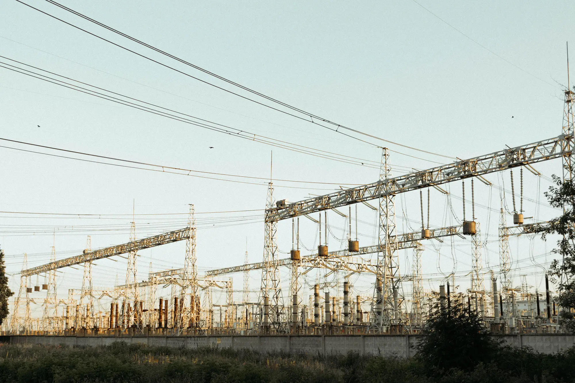
If you spend enough time pulling up yard imagery on new sites, you start to notice the two families look almost nothing alike from above. Gas insulated switchgear (GIS) and air insulated switchgear (AIS) do the same job, isolating and switching bus sections, but they read completely differently in a VHR pass, and knowing which one you're looking at changes how you interpret everything else on the site.
Why the footprint differs so much
AIS is the layout most planners grew up reading: open bus bars strung between lattice structures or steel gantries, with each breaker position visible as its own bay, spaced out for clearance and maintenance access. A 230 kV AIS yard can run several acres just in bus and breaker spacing, and from altitude you can usually count bays by eye, follow the bus runs, and spot a dead-end structure where a line terminates.
GIS compresses all of that into sealed, gas-filled modules, usually housed inside a building or a row of metal-clad enclosures. The switching function that takes up a quarter-acre bay in AIS might fit in a room the size of a two-car garage. From a satellite or aerial pass, a GIS installation often looks like nothing more than a small industrial building sitting next to a transformer yard, sometimes with no visible bus structure at all outside the walls.
That compactness is the whole reason utilities install GIS at sites where land is tight: urban substations, sites boxed in by easements, or yards where expanding the AIS footprint isn't an option. If you're scanning imagery for capacity additions and you're only trained to look for new lattice structures and bus sections, a GIS expansion will slide right past you, because it shows up as a building footprint change instead.
What to actually look for in each case
For AIS sites, the tells are structural and spread across the yard: a new row of support insulators, an added bus section running parallel to the existing one, a new breaker position with its own disconnect switches, or a gantry extension reaching toward an open corner of the yard that used to be bare ground. These changes are usually visible as distinct shapes you can trace pass over pass, because the equipment itself is exposed.
For GIS sites, you're reading the building envelope instead of the bus. Watch for an addition to the switchgear building itself, a new enclosure placed alongside the original one, foundation work or a cleared pad next to the existing structure before the building goes up, and cable trench or duct bank disturbance running from the building toward the transformer positions. None of that looks like "new switchgear" the way an AIS bay does. It looks like construction on a small industrial building, and on a compact or urban site, that's exactly what a GIS capacity addition is.
The transformer yard is often your best cross-check regardless of switchgear type, since GIS and AIS sites both still need transformers sitting in the open, usually behind firewalls or in bunded pads. A new transformer footprint next to a GIS building is a strong signal that the gas insulated bays behind that wall picked up a new position too, even though you can't see the bus work directly.
Mixed sites and partial conversions
Plenty of substations run both: an older AIS yard with a newer GIS extension bolted on for a specific voltage class, or a utility converting one bay to GIS during a rebuild to free up yard space for something else. On these sites, don't expect one consistent read across the whole footprint. Treat the AIS section and the GIS building as two separate things to track pass over pass, because capacity can move into either one without touching the other.
None of this is a substitute for the interconnection filing once it posts, but filings lag construction by months, and a GIS addition in particular is easy to miss if you're relying on a filing summary that describes bus arrangement rather than what the yard looks like from above. Grid Change Monitor runs a quarterly footprint comparison against the last pass for sites you're tracking and flags new bays, transformer additions, and yard construction, GIS buildings included, so you get the early read before the paperwork catches up. If that's the gap you're trying to close on sites you can't walk into, take a look at what a quarterly change list per site actually gives you.